 This Nobody ride started in Duluth. The picture (above) is looking down 6th Ave. East. Lake Superior is in the background. This ride was lead by yours truly, Kickstand, with nobody else riding along.
 We took County Highway 4 north crossing Island Lake about 10 miles north of Duluth. County Highway 4 is a good road and a typical Northern Minnesota highway featuring a lot of forest and low traffic.
ISLAND LAKE BRIDGE
http://www.dnr.state.mn.us/lakefind/showreport.html?downum=69037200

COUNTY HIGHWAY 4

You will find the occasional connivance store/ gas station along Highway 4. There are many lakes and cabins so in the summer these stores keep busy.


This might be the intersection of Highway 4 and Highway 169 near Biwabik
http://www.cityofbiwabik.com/

 Highway 1 heading toward Cook.

This is State Highway 1

State Highway 1

Nice picture of State Highway 1. I like taking pictures of the roads I ride.

I counted about eight 10 mile a hour turns on the section of Highway 1 I traveled. These turns were 90 degrees.

Highway 1 gets noticeably narrower after leaving Cook Minnesota. It is a 14 mile stretch from Cook to Togo.


This is Togo. I think there are about 8 people living in downtown Togo. This building may have once been a school, now it may be an apartment or some type of manufacturing business.

There were three building in Togo. The one pictured above looks like a possible business. The other building was a house. Since there were a couple of guys outside the house with rifles, I chose not to stop and take a picture of them. People in Northern Minnesota are some times touchy about having their picture taken.

Back to civilization at the intersection of Highway 1 and Highway 65. A real bar and grill.

Wandering involves surprises, like this section of construction on Highway 65.

I took County Highway 22 east. Nice road.


Then I took County Highway 25 south.

County Highway 25 intersects County Highway 27. I took 27 east a few miles then continued south on County Highway 7. Traveling through Zim, Sax and Kelsey ( all towns that aren't towns). I then continue to wander toward home with a vague idea of where I was.

COUNTY HIGHWAY 4
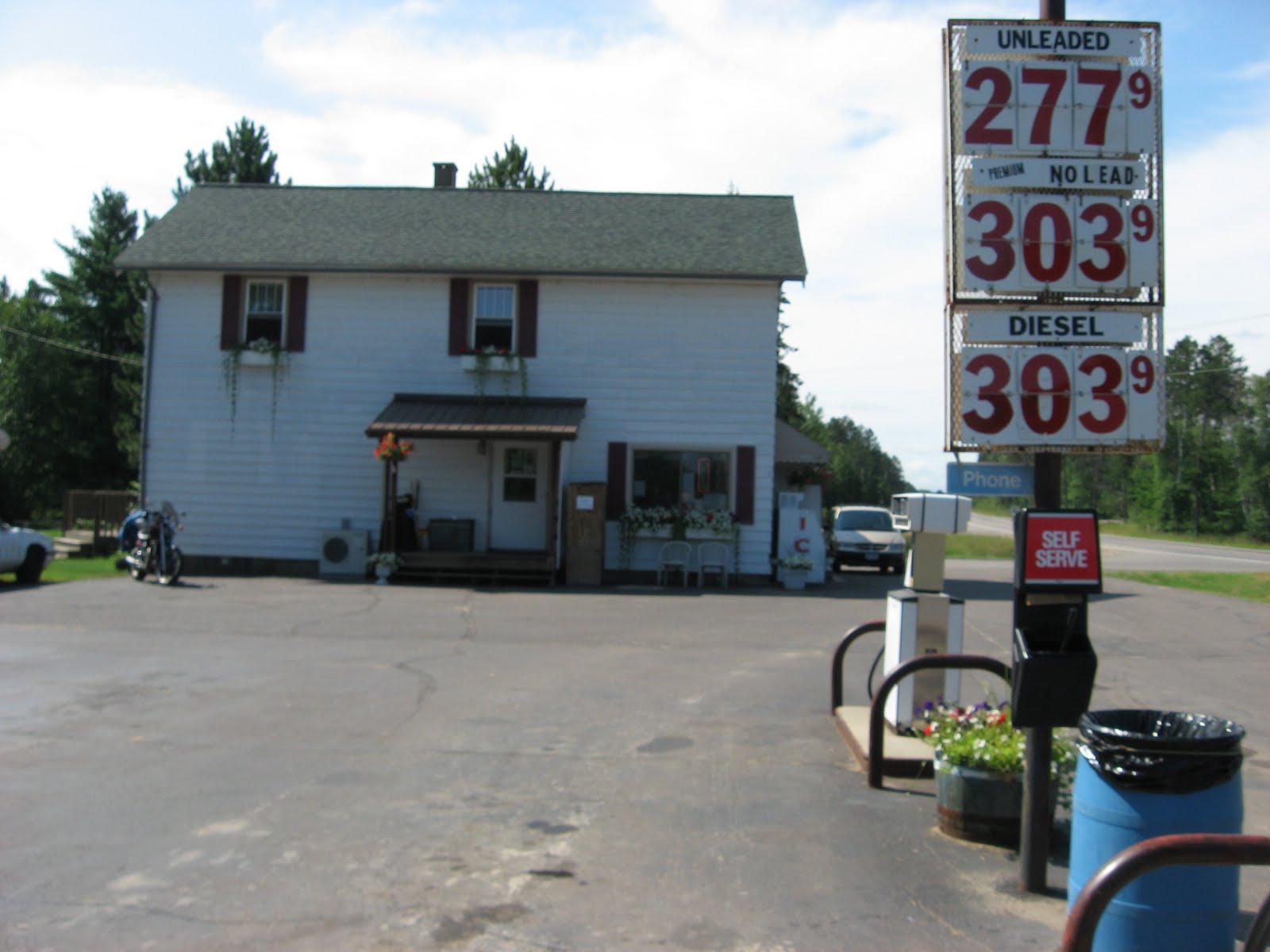
You will find the occasional connivance store/ gas station along Highway 4. There are many lakes and cabins so in the summer these stores keep busy.


This might be the intersection of Highway 4 and Highway 169 near Biwabik
http://www.cityofbiwabik.com/

 Highway 1 heading toward Cook.
This is State Highway 1

State Highway 1

Nice picture of State Highway 1. I like taking pictures of the roads I ride.

I counted about eight 10 mile a hour turns on the section of Highway 1 I traveled. These turns were 90 degrees.

Highway 1 gets noticeably narrower after leaving Cook Minnesota. It is a 14 mile stretch from Cook to Togo.


This is Togo. I think there are about 8 people living in downtown Togo. This building may have once been a school, now it may be an apartment or some type of manufacturing business.

There were three building in Togo. The one pictured above looks like a possible business. The other building was a house. Since there were a couple of guys outside the house with rifles, I chose not to stop and take a picture of them. People in Northern Minnesota are some times touchy about having their picture taken.

Back to civilization at the intersection of Highway 1 and Highway 65. A real bar and grill.

Wandering involves surprises, like this section of construction on Highway 65.

I took County Highway 22 east. Nice road.


Then I took County Highway 25 south.

County Highway 25 intersects County Highway 27. I took 27 east a few miles then continued south on County Highway 7. Traveling through Zim, Sax and Kelsey ( all towns that aren't towns). I then continue to wander toward home with a vague idea of where I was.
I ended up wandering 275 miles, on 5.5 gallons of gas, two bags of peanuts, a cup of coffee and one bottle of apple juice.


No comments:
Post a Comment